10000 Maps helps you create and share maps, easily and effectively. Use 10000Maps for free Use It Now!
Sign Up and you are ready to go
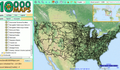
- Thousands of data layers
- Import data from GPS
- Create your own custom layers
- Store your maps in the cloud
- Print maps to PDF
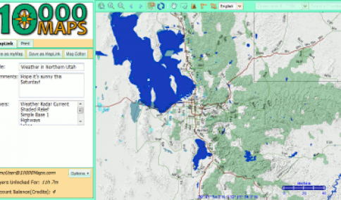
- Share your work with Maplinks


The perfect resource tool for professionals, geographers, educators and travelers! Anyone who uses maps to communicate. We offer over 10,000 online world maps / layers available to download and share. With a unique, user-friendly interface, 10000Maps helps you create and share maps that can be used in classrooms, on the road, and is compatible with personal imported GPS data.
Create your own .pdf and exportable maps with thousands of options including political, agricultural, topographical, and climate maps. Our expansive database includes thousands of data layers that can be combined with your own custom layers to create your own printable .pdf files or share your own online world maps with others.
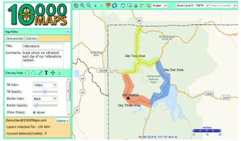
10000Maps is an easy way to create custom maps that you can share with anyone using MapLinks or print in an convenient PDF. Best of all, you can access your online world maps from anywhere at anytime.
Custom online world maps with thousands of features
With 10000Maps, the possibilities are almost endless. We offer hundreds of useful tools to design and create maps that include what you want or need. Not only do our online world maps link with Open Street Map, Google Layers, US Census Data, and Roads Worldwide, but are fully compatible with imported GPS data.
Our online world maps are perfect tools for anyone, in any field. For example, our climate maps are invaluable tools for environmental scientist with data on glacier flowlines, low tide baselines, international fishing territories, and more. Anthropology students will enjoy our maps of archeological sites throughout Europe, Egypt, and Asia. Research new transportation routes for merchandise and more with just one easy-to-use mapping tool.
Create your own design
With 10000Maps, you can use our maps to display crucial data and customize each map to display the information you need. Whether you need a climate map of Uzbekistan or a demographic map of Brooklyn, our features make it easy to show any from the oil platforms in the Gulf of Mexico, to shipwreck coordinates in Australia.
10000Maps is easy for journalists, researchers, and casual travellers wishing to explore new worlds through the convenience of online world maps. With connections to MapLinks, Google Layers, and even traffic data, our maps can be custom built to your needs with our easy-to-use interface.
Try us at 10000Maps today to create your own map and view our geographical, agricultural, economic, and climate maps. It is free and easy to use. Sign up to design your own online world maps today. There are no obligations.